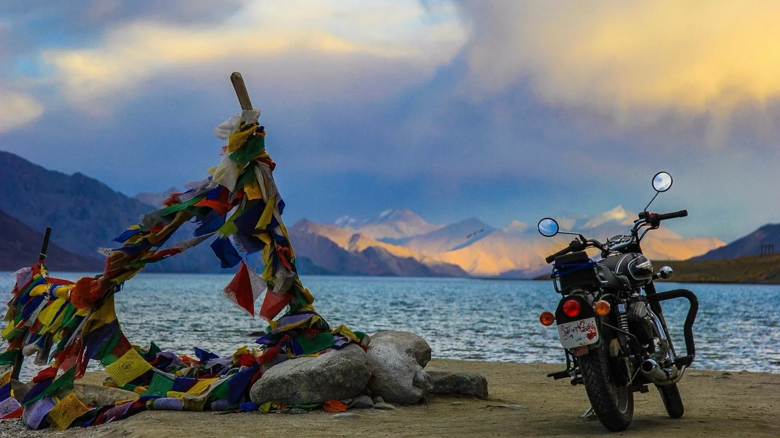
Ladakh and Kashmir Travel Guide
The routes, the valleys and the trips worth knowing about before you pick an itinerary - written from the ground, not from a brochure.
Covers the classic Ladakh bike route day by day, the low-elevation Indus valley excursions used for acclimatisation, offbeat Gurez valley, how Dal Lake houseboats and shikaras actually work, and what the Chadar trek across the frozen Zanskar involves.
The Ultimate Ladakh Bike Trip Guide
Executing a successful motorcycle tour across Ladakh requires choosing an appropriate bike, securing permits, budgeting accurately, and carrying essential gear. High-displacement adventure tourers, such as the liquid-cooled Royal Enfield Himalayan 450, offer distinct performance benefits over traditional air-cooled 350cc or 500cc single-cylinder motorcycles. Electronic Fuel Injection (EFI) systems automatically adjust air-fuel ratios as barometric pressure declines at extreme altitudes, maintaining consistent power delivery. In contrast, carbureted motorcycles experience rich air-fuel mixtures, resulting in spark plug fouling, increased fuel consumption, and noticeable power losses above 14,000 feet.
Expedition logistics require securing an Inner Line Permit (ILP) for restricted border zones, including Nubra Valley, Pangong Tso, Tso Moriri, and Hanle. Riders should carry spare engine oil, inner tubes, a puncture repair kit, a portable 12V air compressor, extra clutch cables, brake pads, and heavy-duty tie-down straps. Essential personal equipment includes a three-layer riding jacket with a removable thermal liner, waterproof motorcycling boots, winter riding gloves, rain gear, and a hydration bladder. Fuel management is critical; motorcycles must achieve a minimum unrefueled range of 350 to 400 kilometers when traveling through remote Changthang sectors.
Motorcycle Trip Prep Guide: Gear, Maintenance, and Water Crossings
Preparing a motorcycle for high-altitude conditions involves targeted mechanical prep and mastering specific riding techniques. Extreme temperatures, unpaved surfaces, fine dust, and river crossings place heavy demands on vehicle systems.
Drive chain care requires regular maintenance; off-road dust strips chain lubricant, accelerating sprocket wear. Riders should clean and lubricate the drive chain every evening and maintain slightly looser chain tension to accommodate full suspension movement over rough terrain. Air filters require frequent inspection and cleaning, as high-altitude power output degrades rapidly if airflow is restricted by dust.
Navigating water crossings (pagal nallahs) requires proper technique to avoid stalling or hydrolocking the engine. Before entering a deep meltwater stream, riders should observe preceding vehicles or walk the route to locate submerged boulders, deep holes, and fast currents. Vehicles should enter the stream in first gear, maintaining steady throttle momentum to prevent water from entering the exhaust pipe. Riders should avoid slipping the clutch excessively or shifting gears mid-stream, steering along a smooth arc toward the exit bank. If a motorcycle stalls in deep water, the engine should not be restarted until the airbox and spark plug well are inspected for water ingress.
Hanle and Umling La Expedition Guide
Umling La stands as the highest motorable road in the world, with an officially verified survey altitude of 19,024 feet (5,798 meters). Constructed by the BRO under Project Himank, the 52-kilometer asphalt road links Chisumle and Demchok, running within 15 kilometers of the Line of Actual Control (LAC). Staging an expedition to Umling La requires using the village of Hanle (14,764 ft) as an operational base.
At 19,024 feet, the effective atmospheric pressure drops to roughly half of sea-level values, reducing arterial oxygen saturation and placing severe physiological stress on the human body. Travelers should spend at least two nights at intermediate altitudes, such as Leh and Hanle, before attempting the pass. Time spent at the summit should be limited to 20 - 30 minutes to mitigate the risk of acute mountain sickness, hypothermia, or sudden hypoxia.
In addition to its role as an expedition hub, Hanle is home to the Indian Astronomical Observatory and India's first designated Dark Sky Reserve. Strict lighting regulations preserve the region's high atmospheric clarity for optical and gamma-ray astronomy. Visitors staying in Hanle's Astro-homestays must adhere to light-pollution protocols, using red-light flashlights and shielding external light sources after dark.
High-Altitude Survival, Itineraries, and Regulatory Compliance
Devil On Wheels Ladakh Survival Guide: AMS Management and Fuel Logistics
Traveling safely through high-altitude environments requires proactive management of physiological risks, fuel planning, and emergency preparation. Acute Mountain Sickness (AMS) occurs when the body fails to adapt quickly enough to reduced atmospheric pressure at elevations above 8,000 to 10,000 feet. Symptoms include throbbing headaches, nausea, dizziness, fatigue, insomnia, and loss of appetite. Left unmanaged, severe AMS can rapidly progress to High Altitude Pulmonary Edema (HAPE) or High Altitude Cerebral Edema (HACE), both of which are life-threatening conditions.
Acclimatization strategy centers on gradual ascent, proper hydration (3 to 4 liters of water daily), avoiding alcohol and sedatives, and minimizing physical exertion during the first 48 hours at high altitude. Prophylactic medications, such as Acetazolamide (Diamox), may assist acclimatization under medical guidance by stimulating breathing, though immediate descent to a lower altitude remains the definitive treatment for severe symptoms.
Fuel management requires careful planning in outer sectors. Outside of Leh town, operational retail fuel stations are limited. Karu, Tangtse, Diskit, and Kargil host functional fuel stations, but supplies can be unpredictable. Travelers entering remote areas like the Changthang Plateau, Hanle, or Tso Moriri must calculate their total distance, add a 25 percent margin for high-altitude fuel burn, and carry extra fuel in approved containers.
7-Day Ideal Leh-Ladakh Itinerary and Acclimatization Schedule
Executing a 7-day itinerary in Ladakh requires a structured schedule to ensure safe acclimatization while visiting key regional highlights.
Day 1: Flight Arrival Leh (11,500 ft) -> Complete Rest
Day 2: Leh Local Sights (Shanti Stupa/Palace) -> Light Walking Acclimatization
Day 3: Indus Valley Drive (Sangam/Magnetic Hill) -> Low-Altitude Excursion
Day 4: Leh to Nubra Valley via Khardung La (17,582 ft) -> Overnight Diskit (10,000 ft)
Day 5: Diskit to Pangong Tso (14,270 ft) via Shyok Valley -> Overnight Spangmik
Day 6: Pangong Tso to Leh via Chang La (17,590 ft) -> Overnight Leh
Day 7: Fly Out from Leh Airport
Day 1: Flight Arrival in Leh (11,500 ft / 3,500 m)
Arrive at Kushok Bakula Rimpoche Airport in Leh. Transfer directly to accommodation and spend the rest of the day lying down to adapt to the sudden altitude shift. Refrain from strenuous walking, showers, or heavy meals.
Day 2: Leh Local Acclimatization Walk
Spend the morning resting. In the late afternoon, take a slow walk through Leh Market or visit the Shanti Stupa to test physical response to light exertion. Monitor pulse-oximeter saturation levels.

Day 3: Low-Elevation Indus Valley Excursion
Drive along the Leh-Srinagar Highway to view the confluence of the Indus and Zanskar rivers at Sangam, visit Magnetic Hill, and explore Gurudwara Pathar Sahib. This excursion maintains a lower altitude (~10,000 to 11,500 ft), promoting acclimatization without overexertion.
Day 4: Leh to Nubra Valley via Khardung La (17,582 ft / 5,359 m)
Depart early for the Nubra Valley over Khardung La. Limit time at the summit pass to under 20 minutes before descending to the lower floor of the Nubra Valley (Diskit/Hunder at ~10,000 ft) for an overnight stay.
Day 5: Diskit to Pangong Tso (14,270 ft / 4,350 m) via Shyok Route
Drive along the Shyok River corridor via Agham and Durbuk to reach Pangong Tso. Check into lakefront homestays or campsites in Spangmik or Lukung. Layer up early to prepare for dropping nighttime temperatures.
Day 6: Pangong Tso to Leh via Chang La (17,590 ft / 5,361 m)
Observe the sunrise over Pangong Lake before returning to Leh across Chang La. Ensure steady driving over gravel patches and stream runoff near the pass summit. Overnight in Leh.
Day 7: Final Departure
Transfer to Leh Airport for morning flight departures.
Complete Guide to Leh Inner Line Permit (ILP) and Border Clearances
Access to restricted border zones in Ladakh is regulated by the Ladakh Autonomous Hill Development Council (LAHDC) through the Inner Line Permit (ILP) framework for domestic citizens and the Protected Area Permit (PAP) system for foreign nationals.
Domestic tourists can complete permit registration online via the official portal (lahdclehpermit.in). The fee structure requires a base Environmental Fee of ₹400 per person, a Wildlife Protection Fee of ₹20 per person per day, and a Red Cross Contribution of ₹10 per person per day. Generated permit receipts remain valid for up to three weeks. Travelers must carry multiple physical photocopies of their permit receipts and valid government photo identification (Aadhaar, Passport, Driving License, or Voter ID), as military checkposts at sites such as North Pullu, South Pullu, Tangtse, Chushul, Loma, and Nyoma retain paper copies for border security records.
Foreign nationals must obtain a Protected Area Permit (PAP) through a registered local travel agency in Leh. PAP applications generally require a minimum group size of two foreign nationals, with permits issued for a maximum duration of 15 days. Foreign tourists face restrictions in certain border sectors; while Hanle is accessible to foreign nationals under designated Astro-stay programs, direct travel along sensitive lines near the Line of Actual Control (such as Umling La or Demchok) remains restricted.
Budgeting a Trip to Kashmir & Ladakh: Cost Breakdowns
Budgeting for an expedition across Jammu, Kashmir, and Ladakh involves managing costs across transportation modes, seasonal accommodation rates, permits, and fuel supplies.
High-altitude touring expenses can be reduced by traveling in shoulder seasons (May or September) when hotels and homestays offer discounted rates. Renting motorcycles locally in Leh helps avoid long highway transit costs from Delhi or Manali, while utilizing shared taxis or local JKSRTC buses significantly lowers transport expenses for solo travelers.
Cultural Circuits, Public Transit, and Frontier Enclaves
Leh Ladakh Travel Guide & Itineraries for Budget Solo Travelers
Budget solo travel across Ladakh is feasible by utilizing the public transit network operated by the JKSRTC and local private minibus operators. Regularly scheduled buses connect Leh with regional hubs including Diskit (Nubra Valley), Spangmik (Pangong Tso), Kargil, Padum (Zanskar), and Nyoma.
Solo travelers can use village-based homestay networks to explore traditional communities at low cost. The Sham Valley circuit - often called the "Baby Trek" - allows travelers to hike between villages such as Likir, Yangthang, Hemis Shukpachan, and Temisgam without heavy expedition gear. Family homestays along this route offer clean lodging, traditional Ladakhi meals made from local organic produce, and direct insight into rural mountain life.
Ladakh Monasteries & Cultural Circuit: Festivals and Cham Dances
Ladakh’s Tibetan Buddhist monasteries (gompas) serve as central institutions of religious, architectural, and cultural heritage across the trans-Himalaya. Constructed on elevated crags and cliffside ledges, these complexes house ancient prayer halls, sacred Buddhist texts, traditional murals, and historic stupas.
A central element of Ladakhi monastic tradition is the annual festival (Tsechu), highlighted by sacred Cham dances. Monks wear silk garments and carved wooden masks representing protective deities, performing structured ritual dances in central monastery courtyards. Accompanied by traditional instruments - including long horns (dungchen), double-reed pipes (gyaling), and cymbals - these performances symbolize the victory of spiritual wisdom over ignorance and purify the surrounding environment.
Turtuk: India’s Last Village and Balti Heritage Guide
Turtuk, situated in the northernmost section of the Nubra region along the Shyok River, was opened to civilian tourism in 2010. Retaken by India during the 1971 Indo-Pakistani War, Turtuk is one of four accessible villages in India that belong to the historic Baltistan region.
Turtuk features a distinct culture, language (Balti), and ethnic heritage compared to the Tibetan-influenced culture of broader Ladakh. Located at a lower altitude (~9,000 ft), the village enjoys a milder climate that supports extensive apricot orchards, walnut trees, and agricultural fields. Visitors can walk through stone-paved alleys, observe traditional timber houses, inspect natural stone cold-storage units (nang-ro), and visit historical sites such as the Balti Heritage Museum and the ancestral home of the Yabgo Royal Dynasty.
Exploring Tso Moriri, Korzok, and Changpa Nomadic Conservation
Tso Moriri is a high-altitude lake located at an elevation of 14,836 feet (4,522 meters) on the Changthang Plateau. Unlike Pangong Tso, Tso Moriri is an oligotrophic wetland protected under the international Ramsar Convention.
The wetland complex surrounding Tso Moriri provides nesting habitats for endangered bird species, including the Black-necked Crane (Grus nigricollis) and the Bar-headed Goose (Anser indicus). Environmental conservation rules strictly prohibit driving vehicles off designated roads onto delicate shoreline meadows.
The lake is anchored by Korzok village, home to Korzok Monastery and traditional Changpa pastoral nomads. The Changpa manage herds of high-altitude Pashmina goats (Changthangi), migrating across seasonal pastures. Visitors should respect local customs, refrain from disturbing livestock, and avoid littering in these fragile high-altitude ecosystems.
Kashmir Valley Heritage, Offbeat Expeditions, and Culinary Arts
Kashmir Travel Guide: Srinagar, Gulmarg, Pahalgam, and Sonamarg
The Kashmir Valley features an alpine landscape enclosed by the Pir Panjal and Great Himalayan mountain ranges. Srinagar, the summer capital, serves as the central entry point, famous for its historic waterways, wooden houseboats, gardens, and urban cultural sites.
Gulmarg, situated at an elevation of 8,694 feet, is a prominent alpine destination featuring golf courses in summer and ski infrastructure in winter. The Gulmarg Gondola lifts visitors up the slopes of Apharwat Peak. Pahalgam, located along the banks of the Lidder River, serves as the base for treks into Aru Valley, Betaab Valley, and Chandanwari. Sonamarg, positioning itself along the banks of the Nallah Sindh, offers access to the Thajiwas Glacier and serves as the launch point for overland transit across Zoji La into Ladakh.

Offbeat Kashmir: Gurez Valley Travel Guide
Located along the Kishanganga River near the Line of Control (LoC), Gurez Valley is a remote frontier region in northern Kashmir. Reached via the 11,672-foot Razdan Pass, Gurez centers on its primary town, Dawar, framed by the pyramidal Habba Khatoon mountain peak.
Visiting Gurez requires navigating military checkpoints due to its proximity to the border. Indian citizens must present government identification cards and complete registration entries at security posts along the Bandipora-Dawar road. Accommodations in Gurez consist primarily of traditional wooden log cabins and local family homestays. The local population belongs to the Dard-Shina ethnic group, maintaining a distinct language and cultural heritage within the Kashmir region.
Kashmiri Food & Wazwan Exploration: Culinary Walks and Teas
Kashmiri cuisine reflects centuries of development influenced by Persian, Central Asian, and regional cooking traditions. The central culinary experience is the Wazwan, a formal multi-course banquet featuring up to 36 distinct courses prepared by master chefs (Vasta Wazas).
The Wazwan is served on a large, hand-carved copper platter called a Trami, shared among four diners. Core courses include Rista (tender pounded meat balls in saffron red gravy), Rogan Josh (lamb braised with Kashmiri red chilies and local spices), Tabakmaaz (seared lamb ribs), and Gushtaba (finely pounded lamb meatballs cooked in a spiced yogurt gravy).
Food walks through Old Srinagar (Downtown near Jamia Masjid and Lal Chowk) offer access to traditional street foods and bakeries. Local bakeries (Kandurs) produce traditional breads such as Girda, Lavas, and Tchochwor, regularly paired with Nun Chai (salted pink tea brewed with sodium bicarbonate) or green tea (Kahwa) infused with saffron, cardamom, and crushed almonds.
Dal Lake Houseboat & Shikara Navigation Guide
The wooden houseboats moored along Dal Lake and Nigeen Lake represent an iconic architectural tradition established during the late nineteenth century. Constructed from hand-carved Deodar cedar, these floating residences feature intricate woodwork (Khatamband paneling) and classic furnishings.
Choosing a houseboat involves considering location and maintenance quality. Mooring locations along Nigeen Lake or the quieter inner channels of Dal Lake offer a peaceful environment compared to busy boulevard sections.
An essential cultural experience is visiting the early morning floating vegetable market. Local farmers meet at dawn in traditional wooden canoes (Shikaras) to trade produce grown on the lake's floating gardens (Rad), maintaining an authentic regional trading system. Travelers should negotiate clear flat hourly rates or fixed route pricing before hiring Shikaras for lake transport.
Alpine Winter Sports and Frozen Expeditions
Winter in Kashmir: Skiing Gulmarg and Heli-Skiing Protocols
From December through March, Gulmarg becomes a key destination for high-altitude ski touring and powder skiing. The Pir Panjal range receives heavy snowfall, creating extensive powder conditions across its sub-alpine terrain and high alpine bowls.
Skiing operations revolve around the multi-stage Gulmarg Gondola. Phase 1 ascends from Gulmarg resort to the Kongdoori Basin (~10,000 ft), servicing beginner and intermediate groomed runs. Phase 2 climbs to the ridge of Apharwat Peak (~13,400 ft), providing access to steep off-piste alpine bowls, chutes, and deep powder terrain. Guided heli-skiing operations access remote backcountry peaks across the Pir Panjal range. Skiers venturing into off-piste zones beyond Phase 2 must carry avalanche safety equipment, including a beacon, probe, and shovel, and check daily avalanche risk advisories.

Chadar Trek Expedition Experience: Frozen Zanskar River Survival
The Chadar Trek is a challenging high-altitude winter expedition across the frozen Zanskar River in Ladakh. During January and February, temperatures in the deep Zanskar Gorge drop to between -15°C and -30°C, freezing the river surface into a sheet of ice - the Chadar.
The 62-kilometer trekking route follows the frozen river channel between Shingra Koma and the frozen waterfall at Naerak. Walking on river ice requires specialized technique; trekkers use a flat-footed, sliding "penguin walk" to distribute body weight evenly across slick ice, reducing the risk of slipping.
The ice sheet is continuously dynamic; shifting water currents and thermal variations can cause sections of ice to melt or break without warning. When the ice sheet yields, trekkers must navigate steep, rocky cliff faces along the canyon walls before descending back onto stable ice downstream. Wearing local rubber gum boots over insulated socks provides traction and water protection when crossing slush or thin ice patches.
Safety compliance for the Chadar Trek is governed by local authorities. Trekkers must complete a mandatory two-day acclimatization period in Leh upon arrival.
On Day 3, trekkers undergo a required medical examination at the Tourist Information Center (TIC) in Leh, where blood pressure and pulse-oximetry levels are tested to certify fitness for high-altitude winter conditions. Mandatory clearances, including LAHDC registration, ALTOA fees, environmental permits, and medical processing costs (~₹9,840), must be secured prior to starting the trek. Trekkers must follow Leave No Trace principles: single-use plastics are prohibited, solid waste must be packed out, and no soaps or chemicals may enter the river, protecting the winter water source for downstream villages.
Executing successful travel expeditions across Kashmir and Ladakh requires careful preparation, timing, and environmental awareness. High-altitude overland journeys - whether navigating major highways, ascending Umling La, or completing the winter Chadar Trek - demand strict compliance with acclimatization schedules, proper vehicle selection, and mandatory permit registration.
By combining thorough route planning with respect for local communities, fragile ecosystems, and cultural heritage, travelers can navigate these trans-Himalayan frontier regions safely and responsibly.
Ladakh in pictures
Photographs from the routes and valleys described above.